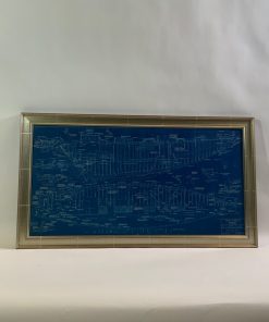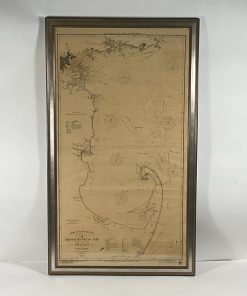


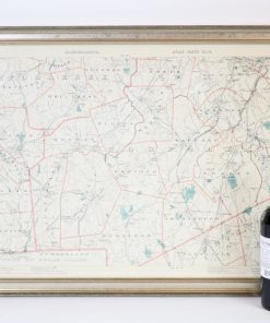
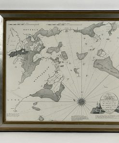
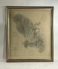
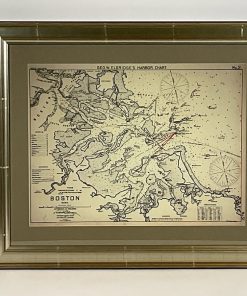
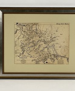
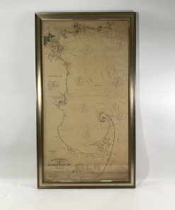
Rare early twentieth century chart of Cape Cod bay by George Eldridge showing Massachusetts Bay, and the coast from Chatham to Gloucester 1918. Signed George Eldridge.
This great chart shows Chatham, Provincetown, Truro, Eastham, Wellfleet, Rock Hollow, Brewster, Dennis, Yarmouth, Barnstable, Yarmouth Port, Sandwich, Manomet, Plymouth, Kingston, Duxbury, Marshfield, Scituate, Cohasset, Hingham, Weymouth Braintree, Quincy, Boston, Medford, Lynn, Winthrop, Nahant, Marblehead, Salem, Beavery, and Galveston.
Weight: 24 lbs.
Overall Dimensions: 60″H x 35″W
Made: American
Material: Paper
Date: 1918
Professionally packed and fast shipping
We provide a variety of shipping options due to our long-standing partnerships with UPS, FedEx and DHL. Our warehouse staff is highly educated to pack your items exactly as per the specifications we offer. Your items are carefully inspected and secured properly prior to shipping. We ship to thousands clients every day from all over the world. The fact that we're committed to becoming the biggest online retailer in the world is evident. Warehouses and distribution centers can be found in Europe as well as the USA.
Note that orders containing more than one item will be given a processing time according to the specific item.
Before shipping Our team will conduct an extensive inspection of the products you have ordered. Today, most orders will be shipped within 48 hours. Delivery is expected to take between 3 and seven days.
Returns
Due to multiple parties, including the factory and the warehouse, we are unable to fully manage stock. Therefore, the actual inventory could alter at any time. It's possible that your order could become unfulfilled when you have placed the order.
The period of time is 30 days. However, if 30 days have passed since you purchased your item, we cannot offer you a return or exchange.
In order for your item to be considered eligible for return, it must be unopened and in the same condition as when you received it. It must also be returned in the original packaging.
Related products


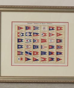


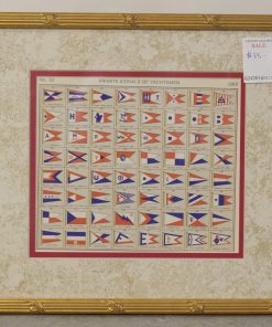

Framed Authentic Page of Private Signals, 1965 Lloyd’s Register, No. 641 to 704 Lannan Gallery